31004: TOBSON, GREAT BERNERA – MILL (Undated)
Summary:
MILL (Undated)
Location:
NB 1447 3835
Full description:
NB03NE 35.01 1447 3835
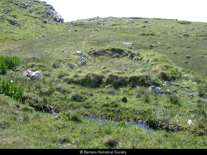
Two mills each comprising an unroofed building, one of which is annotated as a mill (corn), are depicted on the 1st edition of the OS 6-inch map (Island of Lewis, Ross-shire 1854, sheet 17), but they are not shown on the current edition of the OS 1:10000 map (1974).
Information from RCAHMS (AKK) 19 September 1997.
Visible but not identifiable at the time of the coastal erosion survey (SH)
References:
Burgess, Christopher & Church, Michael. 1997. 2 volumes, surveyed 1996, covering the 100m above the high tide line, and the intertidal zone. Coastal Erosion Assessment, Lewis. A Report for Historic Scotland.
Acknowledgement:
Information provided by Western Isles Council Sites & Monuments Record, January 2006.
Record Location
Details
- Record Type:
- Historical or Archaeological Site
- Type Of Site:
- Mill
- SMRRecord ID:
- MWE132258
- Record Maintained by:
- CEBL
Related Media
Mill remains at 1 Tobson