33085: TUAIR – BLACK HOUSE (Undated)
Summary:
BLACK HOUSE (Undated)
Black house
Location:
NB 10258 35351
Full description:
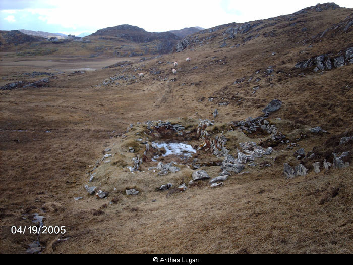
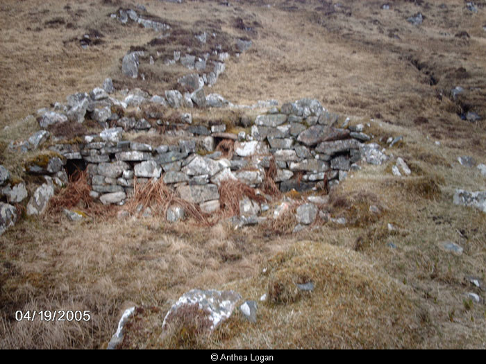
no. 52
This is a blackhouse 14m north-south by 5.5m east-west. A smaller rectilinear structure (6m x 3m externally) adjoins it to the west and is entered from the main structure. This structure may be a later addition. The main entrance is at the south end of the east wall. An original partition divided the structure into two chambers. The northern chamber contains three niches built into the walls (one in each of the north, east and west walls). A small secondary partition has been built into the northern part of this chamber. this latter area is filled with nettles while the remainder of the interior is grass-covered. These secondary partitions also partly block one of the niches.
The walls survive up to 1.8m in height and parts of the east wall show indications of turf construction. All of the corners are rounded.
The site is indicated as occupied on the 1st edition Ordnance Survey map surveyed in 1850, but as unoccupied on the 2nd edition, by which time the associated enclosure is no longer indicated on the map.
Armit 1992, 66
References:
Ian Armit. 1992. CFA, University of Edinburgh Archaeological Field Survey of the Bhaltos (Valtos) Peninsula, Lewis.
1994. ‘Archaeological field survey of the Bhaltos (Valtos) peninsula, Lewis’, Proc Soc Antiq Scot. Part No 124. No.52, 88
Acknowledgement:
Information provided by Western Isles Council Sites & Monuments Record, January 2006.
Additional information from Comunn Eachdraidh Uig:
Wall and track nearby – see photo below.
Record Location
Details
- Record Type:
- Historical or Archaeological Site
- Type Of Site:
- Black House
- SMRRecord ID:
- MWE72746
- Record Maintained by:
- CEU
Related Media
Blackhouse above machair at Kneep
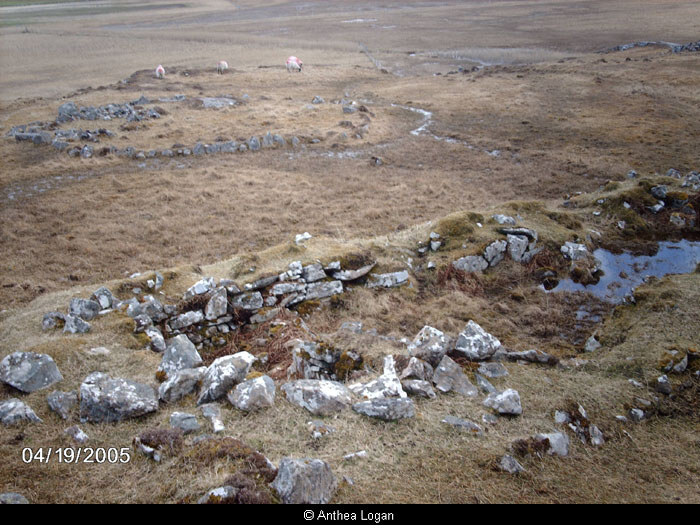
Blackhouse and garden
Blackhouse wall
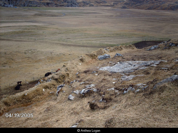
Wall and track at Kneep